
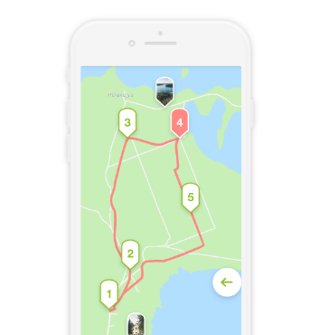
A two-day circular water route starting in Palūšė.
Noteice! There is no junction between the lakes Dringis and Baluošas, so water vehicles need to be transported about 1.5 km by asphalt road.
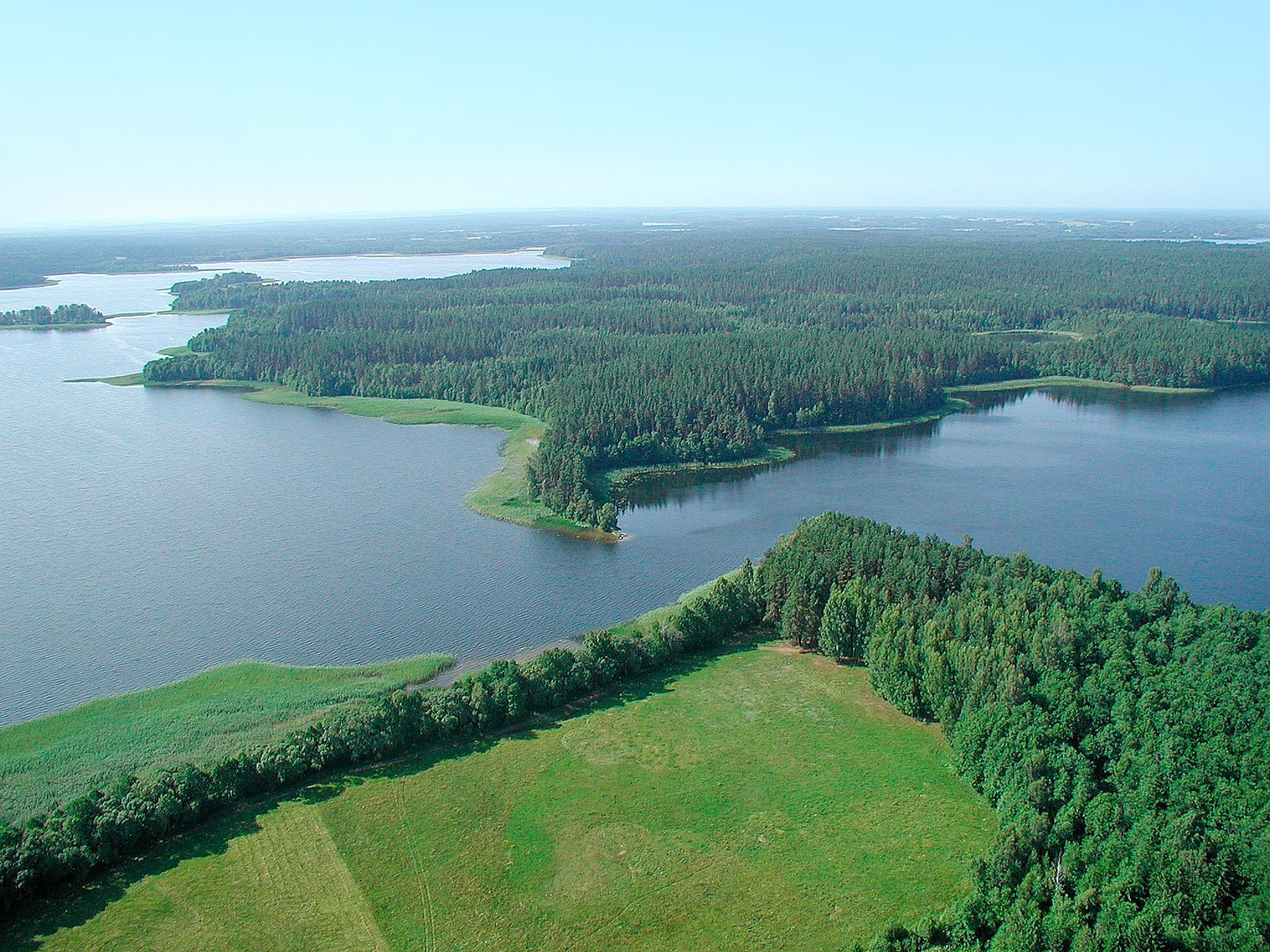
Palūšė - Vaišniūnai. After leaving the Palūšė boat, follow the right, northern shore of Lake Lūšiai. While sailing along the coast, you will be able to see the wooden sculptures arranged along the trail leading towards Meiron. About 2 km on the north bank you will see the village Meironys. Before the village ends on the right, you will reach a stream flowing through the village. Swim into it. After a few hundred meters you will sail to Lake Dringykščiai. At it, turn left at the island and turn north along the creek. After going to Lake Dringis, follow the north direction. On the northern shore of the lake you will see Vaišniūnai village, travel towards it. Before Vaišniūnai, turn left, follow the west direction. You will soon enter Juodakumpis Bay. When you enter it, turn right. On the north bank by the lime tree is the Vaišniūnai campsite - your purpose.
Vaišniūnai - Vaidžiuškės. From the southeastern bay of Lake Baluošas, sail in a northwestern direction. You will reach the Ilgasalė. It has a small lake that you can enter by a stream. Continue west, keep left. You will swim in Vaidžiiuškių village.
Vaidžiuškės - Ginučiai. At Vaidžiuškiai village, you will enter Baluošykščiai via a channel. Further to the south-western corner of the lake, you will reach Lake Srovinaitis by the Skriogžlė stream. Swim west towards Ginučiai village.
Ginučiai - Palūšė. Transfer water vehicles to Ginučiai mill, continue traveling on the Srovė stream. At the confluence, turn right in a northerly direction and 200 m to the lake and head upstream to the Almajo stream. The campsite is located on the eastern shores of Lake Almajo and is recommended for overnight stays. From the campsite, travel down the Almaja (Srovė) River, downstream. You will reach Lake Asėkas, keep right there. The Asėkos stream flows on the southwestern shore of the lake. It will take you to Lake Linkmen. There is a disembarkation point on its west bank, within easy walking distance of Ladakalnis. On the northern shore of the lake there is a landing place near Ginučiai, Papiliakalne mound. From this site, swim south-southeast. When traveling through the channel between Linkmenas and Asalnykščiai lakes, you can stop at the respite site located near Puziniškis mound. After sailing to the lake, stop at Puziniškis village and see the oak growing on the cliff. Cross the strait to Lake Asalnai, follow the south-east direction. After sailing to Lake Lūšiai, keep left and travel east. You will return to Palūšė.


Reviews