
Ažušilė Landscape Reserve cross-country ski trail
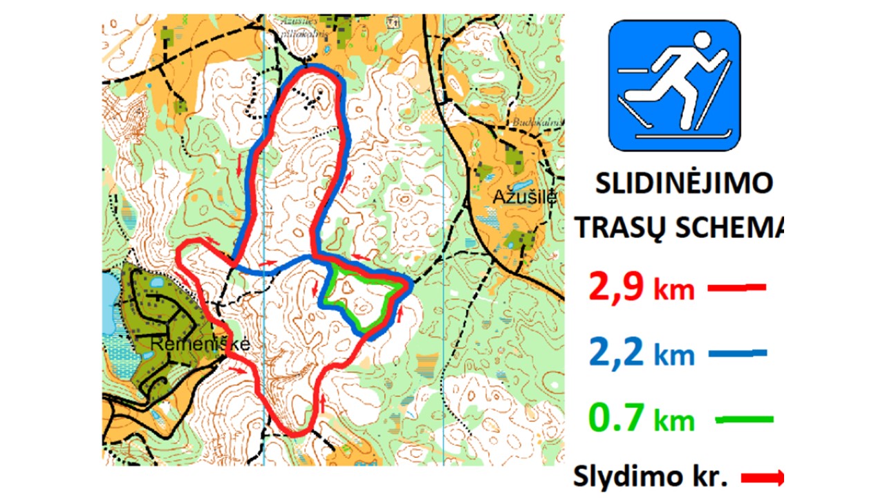
The cross-country skiing trail of Ažušilė Landscape Reserve (AKD) is located in Ažušlė Landscape Reserve - it starts near Remeniškės village (s / b “Tulpė”). It connects with the LŽSC cross-country ski run. The route is 2.9 km with the possibility to turn off the route and visit interesting places of Ažušilė Landscape Reserve, such as Vytautas monument, Ažušilė village, Ažušilė mound, Būdakalnis hill.
The track is marked with colored arrows along the length of the wheel. The 2.9 km circle is a red arrow, the 2.2 km circle is a blue arrow and the 0.7 km circle is a green arrow. There are route diagrams at the beginning of the route and in several other places.
Coordinates: 640273, 6136045 (LKS) 55.339671, 26.211324 (WGS) 55 ° 20 '22.81 ", 26 ° 12' 40.77" (WGS)
Cars can be left in the parking lot near the old LŽSC shooting range (slide the LŽSC route towards Rėmeniškės village)
It is also possible to unwind from the Lithuanian Winter Sports Center
The route was prepared by Orienteering Sports Club "Būdakalnis"
Reviews