
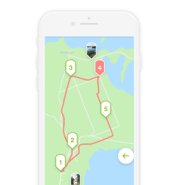
Ring-shaped half day car route that starts in Palūšė.
The route is made up mainly of asphalted roads.
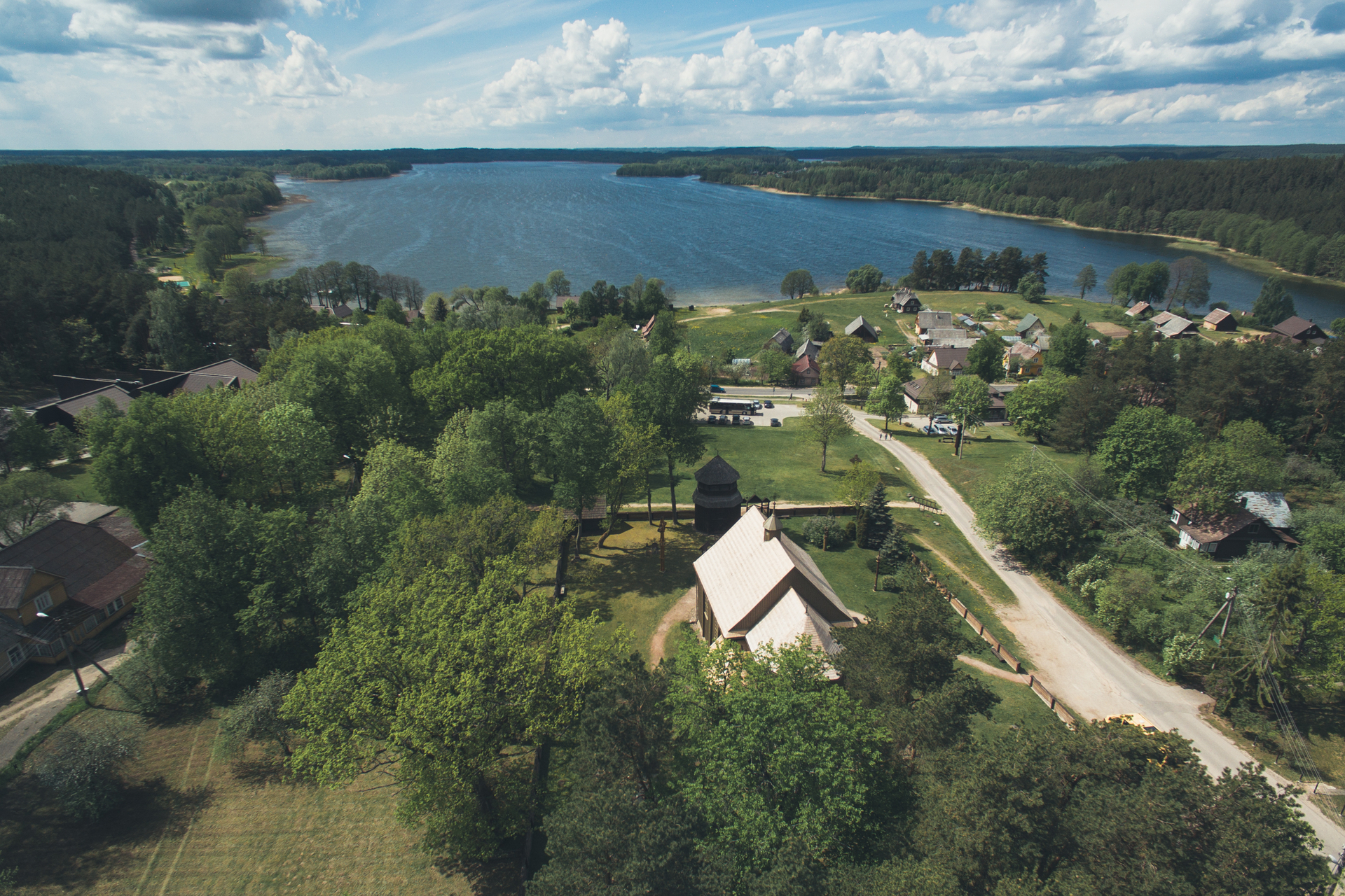
Palūšė - Ginučiai. The route starts at Aukštaitija National Park Visitor Centre. Turn left from the parking lot and drive towards Šakarva in south-western direction. After approximately 3 km you will arrive at Šakarva village. Leaving the village behind, turn right towards Kirdeikiai. At the crossroad, you can take a look at the 12 c. barrows. On your way, you can stop at Kaukiškė parking lot and admire the view of the lakes Lūšykštis and Lūšiai. After 1.5 km from Kaukiškė, you will reach a crossroad. Go straight and after another 2 km, turn right at the crossroad towards Ladakalnis and Ginučiai Mound. After admiring the views that open up from Ladakalnis, we also suggest climbing Ginučiai Mound, which also reveals impressive views. Proceed towards the village of Ginučiai.
Ginučiai - Kirdeikiai. In the village, turn left at the crossroad. After leaving the village of Ginučiai behind, you will soon arrive at Šiliniškės Observation Tower, which will be on the right side of the road. After 3 km down the road, you will reach a crossroad where you need to turn right. After 400 m, there will be another crossroad. Turn right again and drive towards Kirdeikiai. In Kirdeikiai, there is a church worth seeing.
Kirdeikiai - Stripeikiai - Ginučiai. Having passed the village of Kirdeikiai, turn right and go in the direction of Stripeikiai village. Drive along the gravel road up to the village of Stripeikiai. Turn right at the crossroad in the village, and after 500 m you will arrive at the Museum of Ancient Beekeeping. After visiting the museum, proceed along the gravel road. On your way you can stop to see around Papliaušys Hollow Pine, and Papliaušys Spring. After approximately 5 km from the museum, you will get to an asphalted road. Near this crossroad, at the right side of the road, there are Ginučiai barrows in the forest. After taking the right turn, you will arrive to Ginučiai village, and beside the main street, you will see the watermill.
Ginučiai - Vaišniūnai. After visiting the exhibition, go back to the approaches of the village. Proceed along the main asphalted road. In Trainiškis village, you can see the remains of a 800-year-old oak, who fell down during a storm in 2016. From Trainiškis village, go in the eastern direction. After approximately 2.5 km, you will approach Medžiukalnis Spring. It is on the right side of the road. There is a path leading to the spring. Proceed along the asphalted road, and after approximately 400 m you will see Vaišniūnai, Medžiukalnis barrows on the left side of the road. Going further in the eastern direction you will arrive at Vaišniūnai village there you will see Vaišniūnai Oak by the road.
Vaišniūnai - Palūšė. At the crossroad where the village ends, turn right and go towards Ignalina. After 4.6 km from this crossroad you will drive out of the forest. On your right you will see a small asphalted road. After 0.5 km down this road you will see Gaveikėnai mill. After seeing over the watermill, go back to the main road and turn right at the crossroad. After 1.5 km you will get a crossroad. Turn right. After 2 km you will come to Palūšė. On the right side of the road, near Lūšiai lake, you will see Palūšė campsite.


hi, amazing view.. i love how it shows and i love the place with trees