
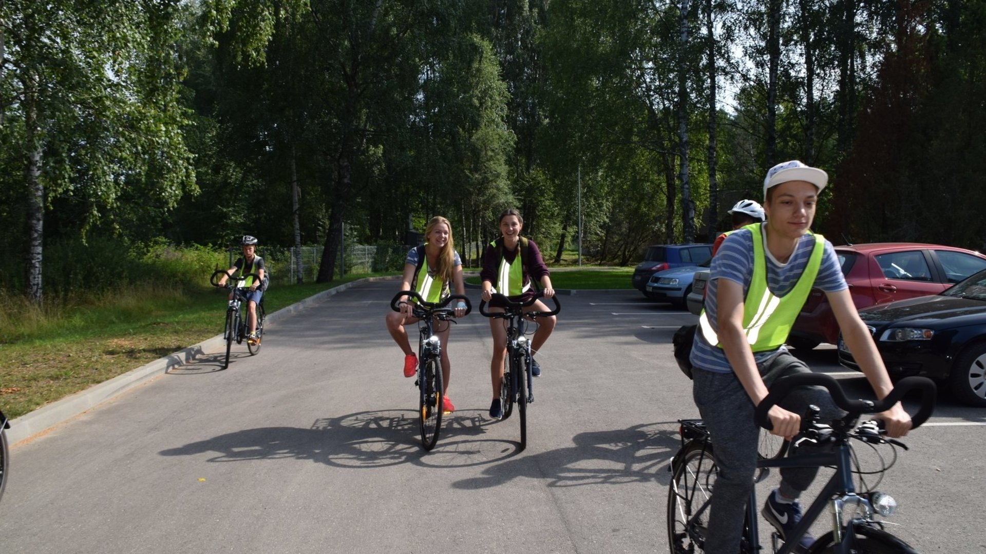
Ring-shaped challenging cycling route that starts in Palūšė.
The route involves various types of roads, including asphalt, gravel roads, forest and meadow paths.
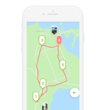
Palūšė - Antalksnė. The route starts at Aukštaitija National Park Visitor Centre. Go left from the parking lot. Then, turn right after passing a shop. In the Pašakarvio Street, Šilinė village, the road makes a sharp left turn. Near the forest, the gravel road turns into a forest path. Go along this road towards Šakarva campsite. Keep going further, and after 50 m, you will reach asphalted road. Turn right, and pass over the Šakarva village. Shortly, you will reach a crossroad where you should take the right turn, towards Kirdeikiai. After 4.3 km in Kaukiškė village, you will see a resting place lot. After another 1.5 km from the Kaukiškė at a crossroad turn right to the village Antalksnė. There are three sculptures on a hill near the crossroad. After approximately 0.5 km you will reach Antalksnė.
Antalksnė - Ginučiai. Turn right at the crossroad. After another 250 m, turn left and go to the village of Salos. At the crossroad turn left and after 1 km you will reach the village of Salos II. At the approaches of the village, when you see a barn at the right side of the road, turn right and go to a three-way crossroad located by the Linkmenas lake. Turn left and after crossing the channel you will arrive at Ladakalnis. From this point, go down along the same path towards Ginučiai Mound in a northern direction. Turn right after reaching asphalted road. After 700 m, there is a resting place at the base of Ginučiai Mound. Go along the asphalted road from Ginučiai, Papiliakalnė Mound to Ginučiai village. At the three-way crossroad, take the right turn. After 600 m, you will reach the watermill.
Ginučiai - Kirdeikiai - Stripeikiai. After looking around, go back along the same road to the last crossroad, and go straight at the crossroad. After going another 1.2 km, you will see a resting place on the right side of the road and Šiliniškės Observation Tower. From the tower, continue along the asphalted road until you reach a three-way crossroad. Take the right turn at the crossroad. After 400 m, you will see another crossroad. Keep to the main road and turn right again, towards the village of Kirdeikiai. In this village, there is a church you can look over. Outside the town, you will see a sign directing to the Museum of Ancient Beekeeping. Turn right. Go along the gravel road in a northern direction. After entering the forest, you will see a forest road branching off to the right after 150 m, it will take you to Pakasas Watermill. After seeing around the watermill, go back to the main road. Turn right, and go towards Stripeikiai village.
Stripeikiai - Daunoriai. At the crossroad, take the right turn. After passing across the Stripeikiai village, you will see the Museum of Ancient Beekeeping on a hill on your left. After seeing the exhibition, go back to the village Stripeikiai. At the four-way crossroad, turn right and go in the northern direction. After approximately 2.5 km you will arrive at the crossroad in Varniškės village (after turning right you will reach the etnoghraphic village Varniškės II after 1.7 km. After seeing around, go back along the same road, and turn right at the crossroad). Go straight in the northern direction. After 2 km, you will reach Daunoriai.
Daunoriai - Vaišniūnai. At the crossroad, take the right turn. In the village there is a nice church you can look around. After reaching another three-way crossroad, turn right again. Go along the gravel road for approximately 5.5 km. At Vaišnoriškė village, the road diverges. The village is on the left, across the river. After visiting the village, keep left at the crossroad. After 1.5 km, you will arrive at etnographic village of Strazdai. Outside the village of Strazdai, there will be a bridge across the river Būka. After approximately 200 m from the bridge, you will reach a crossroad where you need to take the right turn, towards Šuminai village. in the village you will reach a crossroad where you need to turn left. Keep right at further road forks. After approximately 3 km from Šuminai, you will reach an asphalt road. Turn left at the crossroad. After 600 m, you will reach Vaišniūnai village.
Vaišniūnai - Palūšė. After passing through the village, turn right in the direction of Ignalina. After 4.6 km, you will go out of the forest. There will be a small byway on your right leading along the outer wood. After 0.5 km down this road, you will arrive at Gaveikėnai watermill. Go straight from the watermill through the village of Gaveikėnai. At the end of the village, go straight. On your right, you will see the forest, and farm buildings on the left. After 0.5km, there will be a clearing on your left. Immediately after this clearing you will see a forest road branching to the left. Take this road. After 0.5 km along this road you will reach asphalted road. Turn left. After 300 m, you will see a forest road branching to the right. Go along this road. After 300 m along this road, you will reach asphalted road. After crossing the road, turn right to the bicycle path. Asphalted bicycle path leads through the forest parallel to the main road, and ends in Palūšė.


Reviews